Taxiplans
Performing ground taxi of aircraft can be either difficult (on airports you do not know) or boring.
That's why we invented taxi plans and the GPS recorder.
In short, you do a pretty precise taxi by hand once and in future you just select a taxi plan and let FSXPilot do the job.
First you should try one of the demo taxi plans provided with FSXPilot.
How to use a taxi plan
Please start up FSX and place a Learjet at Gate 103 in EDDM - Munich, Germany.
To do this find Munich airport in FSX airport list and select (drop down menu) the position where to start your flight - GATE 103.
Load the flight and start FSXPilot.
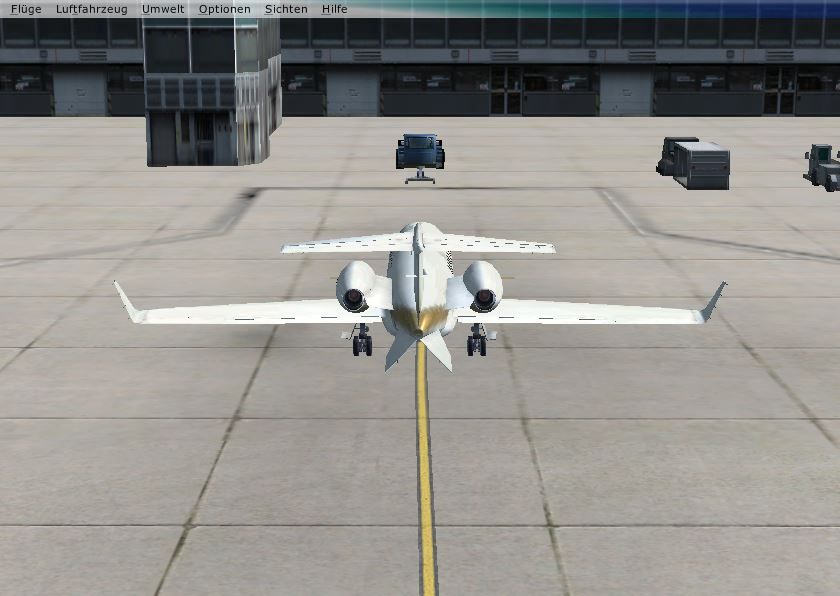
Load the flight plan 'TAXI_EDDM_GATE103_08L_w_pushback' and run the flight plan.
Lean back. You will see that the aircraft will perform a push back ...
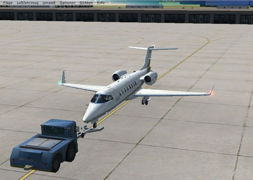
... and then follow the usual taxiways used for departure aircraft. You can modify the taxi speed via the AP panel - 5 knt are preselected, 10 are possible, more than 15 usually not recommended. You can go a bit faster if you have straight taxiways ;-) And if you are in a hurry consider using moderate time acceleration rather than speeding up the plane. 20 knt is the speed limit for real ground taxi in Munich.
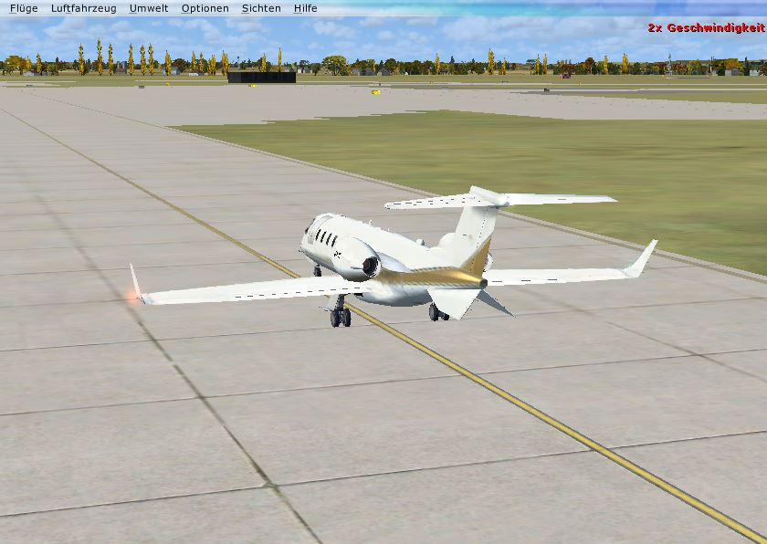
The plane stops at the holding point of one of the first entries to runway 08l, end of flight plan.
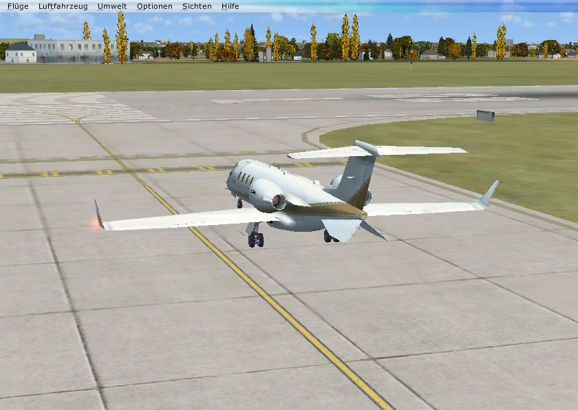
After manual 'line up' on runway you can either takeoff manually or start up the autopilot for automated takeoff.
Similarly, after landing on a different runway, let's say runway 26R in Munich, you can load the taxi plan 'TAXI_EDDM_26R_GATE103' and run the plan.
Lean back and enjoy the taxi back to your home gate. In total we made 12 demo taxi plans from gate 103 to all active runways and from all active runways back to gate 103.
How to use the GPS recorder and produce a taxi plan
To produce one of those plans for your home airport and favorite gate is quite easy.
Power up FSX, select your favorite gate and wait until the session starts. Start FSXPilot and switch AP on. Select "Start GPS recording ..." from the 'Extra' menu entry of the AP panel. Do a precise taxi by hand, preferably at the speed of 5 knts. At your desired holding point "Stop GPS recording ..." via the "Extra" menu. A dialog box will open and ask you for the name of the taxi plan. Give it a good name and press ok. After that, you will find your new plan containing all the necessary commands as a new text file in the "Flightplan" dir of your FSXPilot home dir.
Please note that is is not possible to record a push back with the GPS recording function. If you need a push back, please start your GPS recording after any pushback you might have performed and enter a
toggle pushback
wait 60.
toggle pushback
before the "set speed 5" command.
See an example (without pushback) here: TAXI EDDM 08L GATE103
//
// FSXPilot (c) by Scientific Networks, Munich
//
// GPS recorded taxi-/flightplan
//
navlights on
strobelights on
set apcontrol plane
set speedunits knots
set distanceunits miles
set userinput on
set speed 5
maintain speed
run apv
gpswaypoint 1491.4 0.0 48.36513983 11.79861391
gpswaypoint 1491.4 7.2 48.36490078 11.79919363
gpswaypoint 1491.4 7.8 48.36468904 11.79979468
gpswaypoint 1491.4 7.4 48.36448414 11.80040086
gpswaypoint 1491.4 7.0 48.36427581 11.80100790
gpswaypoint 1491.4 6.8 48.36406749 11.80161578
gpswaypoint 1491.4 6.8 48.36385917 11.80222282
gpswaypoint 1491.4 6.8 48.36365427 11.80282985
gpswaypoint 1491.4 6.8 48.36344595 11.80343517
gpswaypoint 1491.4 6.8 48.36324104 11.80404648
gpswaypoint 1491.4 6.8 48.36303614 11.80465436
gpswaypoint 1491.4 6.7 48.36280391 11.80524005
gpswaypoint 1491.4 6.8 48.36246923 11.80478414
gpswaypoint 1491.4 7.0 48.36241459 11.80411136
gpswaypoint 1491.4 7.0 48.36235312 11.80343347
gpswaypoint 1491.4 6.9 48.36229164 11.80275984
gpswaypoint 1491.4 6.8 48.36225066 11.80208194
gpswaypoint 1491.4 6.8 48.36221993 11.80140405
gpswaypoint 1491.4 6.9 48.36215163 11.80072956
gpswaypoint 1491.4 6.9 48.36207991 11.80005679
gpswaypoint 1491.4 6.8 48.36201161 11.79938743
gpswaypoint 1491.4 6.8 48.36194672 11.79871551
gpswaypoint 1491.4 6.9 48.36188866 11.79803676
gpswaypoint 1491.4 9.6 48.36183744 11.79735716
gpswaypoint 1491.4 10.5 48.36179646 11.79667329
gpswaypoint 1491.4 10.6 48.36175889 11.79599539
gpswaypoint 1491.4 10.4 48.36171791 11.79531152
gpswaypoint 1491.4 10.0 48.36167010 11.79462423
gpswaypoint 1491.4 9.8 48.36162229 11.79394804
gpswaypoint 1491.4 9.7 48.36157789 11.79327014
gpswaypoint 1491.4 9.7 48.36153008 11.79259310
gpswaypoint 1491.4 9.7 48.36148227 11.79191947
gpswaypoint 1491.4 9.8 48.36143446 11.79124072
gpswaypoint 1491.4 9.8 48.36139006 11.79056197
gpswaypoint 1491.4 9.8 48.36134225 11.78988920
gpswaypoint 1491.4 9.8 48.36129444 11.78920960
gpswaypoint 1491.4 9.8 48.36124663 11.78853170
gpswaypoint 1491.4 9.8 48.36119198 11.78784868
gpswaypoint 1491.4 9.8 48.36113734 11.78717249
gpswaypoint 1491.4 9.8 48.36108270 11.78649118
gpswaypoint 1491.4 9.8 48.36102806 11.78581499
gpswaypoint 1491.4 9.8 48.36097000 11.78513454
gpswaypoint 1491.4 9.8 48.36091536 11.78445579
gpswaypoint 1491.4 9.8 48.36086072 11.78377447
gpswaypoint 1491.4 9.8 48.36080608 11.78309743
gpswaypoint 1491.4 9.8 48.36075144 11.78242039
gpswaypoint 1491.4 9.8 48.36069680 11.78173908
gpswaypoint 1491.4 9.8 48.36063874 11.78106289
gpswaypoint 1491.4 9.8 48.36058410 11.78038158
gpswaypoint 1491.4 9.8 48.36054312 11.77970283
gpswaypoint 1491.4 8.9 48.36049189 11.77902322
gpswaypoint 1491.4 6.6 48.36044408 11.77834703
gpswaypoint 1491.4 6.0 48.36039285 11.77766914
gpswaypoint 1491.4 6.4 48.36030747 11.77700234
gpswaypoint 1491.4 6.8 48.35991815 11.77666254
gpswaypoint 1491.4 7.0 48.35946736 11.77665827
gpswaypoint 1491.4 6.9 48.35901998 11.77672401
gpswaypoint 1491.4 6.9 48.35857261 11.77681366
gpswaypoint 1491.4 6.8 48.35812181 11.77689306
gpswaypoint 1491.4 6.7 48.35772566 11.77722688
gpswaypoint 1491.4 6.9 48.35774615 11.77790905
gpswaypoint 1491.4 6.9 48.35778714 11.77858609
gpswaypoint 1491.4 6.9 48.35784178 11.77925801
gpswaypoint 1491.4 6.8 48.35789983 11.77992993
gpswaypoint 1491.4 6.7 48.35757540 11.78040463
gpswaypoint 1491.4 6.6 48.35713144 11.78053611
gpswaypoint 1491.4 7.1 48.35714510 11.78121315
stop apv
stop aph
head ch
set speed 0.
operate wheelbrake
wait 2.
release wheelbrake
flaps 0.
end
Technically, GPS recording saves a GPS waypoint every 50 meters on ground and approx every 5 km in the air. Recording a complete flight (takeoff, cruise, landing) currently does not result in a flight plan which will initially work.
Now go back to start and try your new plan out.
Created with the Personal Edition of HelpNDoc: Free EPub producer